Seeking to capture the dynamic and changing character of the city, Edmonton requested a digital map for residents and visitors that highlights the changing seasons.
Using open-source map data, Living Map designed a map that highlights the city’s main attractions and locations based on the time of year. The map features interchangeable stylesheets highlighting different information in summer and winter.

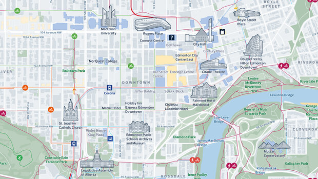
To give access to new visitors, ensuring that both disabled and non-disabled individuals, regardless of their characteristics, can easily navigate and explore the area, 5 digital screens with a large format interface were deployed at key hubs to promote activities in the local area, while a parallel map was developed for mobile use highlighting cycling and walking options.
The map is highly responsive and integrated with data feeds for the up-to-date information including real-time departures from the area transport hubs. Users can scan a QR code on digital screens to take the map with them on their mobile devices.
Smart Spaces case studies

Canary Wharf Case Study
A renowned shopping destination in London, embarked on a mission to enhance its visitors' experience through a comprehensive digital wayfinding strategy.

Waltham Forest Case Study
A customised digital map to improve accessibility for all with content curated by Waltham Forest’s council, for digital distribution
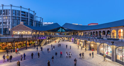
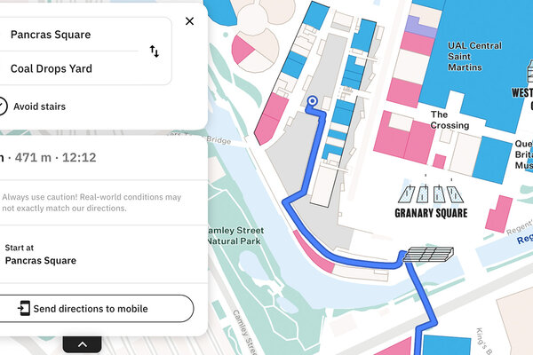
Kings Cross Case Study
King’s Cross, renowned for its diverse mix of shops, cafes, bars and restaurants nestled within its cobbled streets and brick arches, aimed to optimise visitor exploration.
Latest Smart Spaces news and resources


Request a demo
Experience the power of our mapping, wayfinding, and navigation technology for yourself. See how our software can enhance the customer experience in your facility.