Designing the Next Era of Navigation: Phil Rae on the Wayfinding XChange Podcast

What happens when the building itself can’t tell you where to go? When a hospital campus spans twenty buildings across a hundred years of architecture, when a shopping centre hides its most-searched shop behind a corner nobody walks past, or when a facilities contractor spends two hours looking for a water meter that’s marked on a piece of paper locked in someone else’s desk?
These are the problems that Living Map solves every day. And in a wide-ranging conversation on the Wayfinding XChange podcast, our Chief Product and Technology Officer, Phil Rae, explored the relationship between physical space, digital technology and the people who navigate both.
Hosted by wayfinding design director Alison Richings, the episode covers everything from reducing patient anxiety in NHS hospitals to why nobody downloads apps anymore, and what augmented reality might look like when it finally arrives — not on your phone, but in your glasses.
Below, we’ve drawn out the key themes and insights from the conversation. Or you can listen to the full episode on Apple Podcasts or Spotify.
The Map as a Single Source of Truth
Every large building has information about its structure — usually scattered across CAD files, architect drawings and floor plans that live in different folders, on different desks, in different departments. Living Map takes that fragmented information and converts it into a single, ground-truth digital map: one data set, georeferenced to real-world coordinates, that can serve every use case a building has.
But a map isn’t just a tool for visitors. Phil described how the same map data set that guides a museum visitor to a specific gallery can also show a facilities engineer where the water mains are, or an IT team where every network node sits. Different layers, different presentations, same underlying truth.
For many clients, this is a light-bulb moment. The customer experience team commissions a visitor map, and then discovers that the same platform can serve facilities, maintenance and IT — pooling budgets and unlocking operational value they hadn’t anticipated.
“We accept those CAD diagrams, architect diagrams, convert them into a format that is map-based, GIS-based, and then from there you can construct maps that satisfy different use cases. We’ve become the provider of indoor maps and campus maps — mapping information that clients can ask for and control.” said Phil Rae, Chief Product Officer at Living Map.
Reducing Patient Anxiety Before They Arrive
Of all the environments Phil discussed, hospitals drew the most detailed treatment — and for good reason. A hospital visit is uniquely stressful: you probably don’t want to be there, it’s likely your first time, you’re anxious about your appointment, and you’re almost certainly in the wrong car park.
NHS hospital campuses are often sprawling collections of buildings — some over a hundred years old, some brand new — connected by covered walkways and served by inconsistent signage that changes from building to building. A consistent digital map experience, guiding someone from the car park entrance to the reception of the department they need, makes a material difference to patient experience.
But Phil went further than the in-the-moment experience. Living Map’s platform allows every single point of interest, every route and even the zoom state of the map to be deep-linked via a URL. That means a QR code printed in an appointment letter can take a patient directly to a pre-loaded route from the right car park to the right department — before they even leave home.
This is wayfinding as anxiety reduction — not just navigation, but preparation. It shifts the intervention upstream, from the moment of stress to the moment of planning.
What Your Kiosk Data Is Telling You About Your Building
Shopping centres present a different challenge. Visitors are there to browse, not to reach a specific appointment, and their stress levels are typically low. But the wayfinding data from these environments can be surprisingly revealing.
Phil shared an example of a shopping centre client where kiosk search data showed that one particular shop was consistently the most searched-for destination — but only from one specific point in the centre. That insight told the client something signage alone never could: there’s a wayfinding blind spot at that exact location, and a simple physical sign could resolve it.
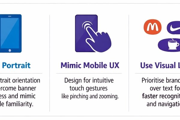
The conversation also surfaced practical design wisdom that sounds obvious in hindsight but catches many clients off guard: kiosk screens should be portrait, not landscape. Landscape screens trigger banner blindness — they look like TVs, not interactive tools. Portrait screens, like the ordering terminals now standard in every fast-food restaurant, signal interactivity immediately.
A Map Is Never Done
One of the most candid moments in the conversation came when Phil was asked about hidden costs and risks. His answer was disarmingly simple: the map is never finished.
“The map is never done — and it’s in our name. It’s a living entity. The map we deliver on day one could change at any point. Clients always need to ensure that there’s somebody responsible for its upkeep.”
Buildings change. Shops move. Galleries close temporarily. Departments relocate. A digital map that isn’t maintained becomes a liability rather than an asset. Living Map’s platform is designed for this reality: clients manage their own map content through the Map Management System, closing galleries, updating points of interest and adjusting routes without needing to come back to Living Map’s team.
The platform can even pull in external data — crowd-counting sensors, for example — to dynamically reroute visitors away from congested areas in real time. It’s a map that responds to the building as it is right now, not as it was when the project launched.
The Operational Case: Back of House
One of the most underappreciated use cases for digital mapping isn’t visitor-facing at all. Phil described how the same map that guides the public through a museum or hospital can also serve the teams who maintain it: electricians looking for sockets, engineers locating gas mains, IT teams mapping network infrastructure.
“These contractors cost time per hour. If they spend two hours trying to find a water meter, that’s two hours of wasted money. There’s a clear return on investment in mapping where all these utility things are.”
Traditionally, this information lives on architect diagrams, hand-drawn sketches or in someone’s head. When that person is on leave and an emergency fix is needed, the information is inaccessible. A digital map with facilities layers makes it shareable, searchable and available to anyone who needs it — instantly.
Phil noted that inbound enquiries are increasingly coming from facilities teams rather than customer experience teams. The sell is often easier from this direction: a facilities team sees the operational value immediately, and the visitor wayfinding layer becomes a natural extension.
The Blue Dot Problem: Indoor Positioning
Outdoor navigation is a solved problem. GPS puts a blue dot on a map, and we follow it without thinking. Indoors, everything changes.
Satellite signals can’t penetrate buildings reliably. Even if they could, they can’t distinguish between floors. And on a map where every floor looks similar, the hardest thing a user has to do is work out where they actually are.
Bluetooth beacon infrastructure can solve this, but it comes with significant cost, installation effort and ongoing maintenance. Critically, it requires a native app to access the phone’s Bluetooth sensors — and as Phil put it bluntly, app downloads are a distribution barrier that most venues can’t overcome. Living Map’s web-based approach avoids this entirely: no download, no app store, just a link that works on any device.
The Future: Augmented Reality, Wearables and the Map That Doesn’t Disappear
The conversation turned to what comes next. Phil has fielded plenty of enquiries about augmented reality — holding up your phone and seeing a navigation route projected over the real world through the camera. In theory, it’s compelling. In practice, he challenges anyone to hold their phone up for more than ten seconds.
The real breakthrough, Phil suggested, won’t come from phones. It will come from glasses — the evolution of devices like Apple’s Vision Pro into something lightweight enough to wear without looking, as he put it, like an idiot walking through a hospital. Eventually, perhaps contact lenses. Half the population already wears glasses, so the form factor isn’t a barrier — only the technology needs to catch up.
“I think augmented reality will happen when it’s in glasses or even contact lenses. Half the population already wears glasses, so it’s not weird. When you can see things projected in front of you, that’s when AR will genuinely be a thing.”
But even in that future, Phil doesn’t see the map disappearing. The interface will evolve, but the underlying map data — the source of truth about a building — will remain essential. Indoor maps will be customised to the venue, just as they are today, with brand colours, landmark illustrations and tailored routing. The blue dot and the blue line will persist. The conventions are set.
Digital Maps Are Part of the Experience, Not the Whole Experience
Perhaps the most resonant moment came at the end, when Phil described watching security guards at Canary Wharf walk visitors over to a Living Map kiosk to help them search for their destination — rather than just pointing down a corridor.
“Don’t assume that if you’ve got a digital map, that’s all you need. It’s a full experience all the way through — walking into the space, seeing the signs, seeing what’s there, orienting yourself. A digital map is part of that.”
It’s a simple observation, but it carries a significant point. Digital wayfinding works best when it complements human interaction, not when it replaces it. A welcome desk with an iPad showing the map. A QR code that lets a visitor take the map with them. A security guard who uses the kiosk as a shared tool rather than a substitute for conversation.
Living Map’s technology is sophisticated — dynamic routing, real-time data integration, deep-linkable map states — but its most powerful application is in the moments where it makes a human interaction easier, not where it removes one.
Listen to the Full Episode
Phil’s conversation with Alison Richings covers even more ground than we’ve captured here, including the history of map conventions, why the London Underground map is “the biggest lie” in cartography, and what the A-to-Z meant to a generation of Londoners. It’s a wide-ranging, honest discussion about the relationship between space, technology, trust and the people who navigate both.
Request a demo
Experience the power of our mapping, wayfinding, and asset tracking technology for yourself. See how our software can enhance your facility.