
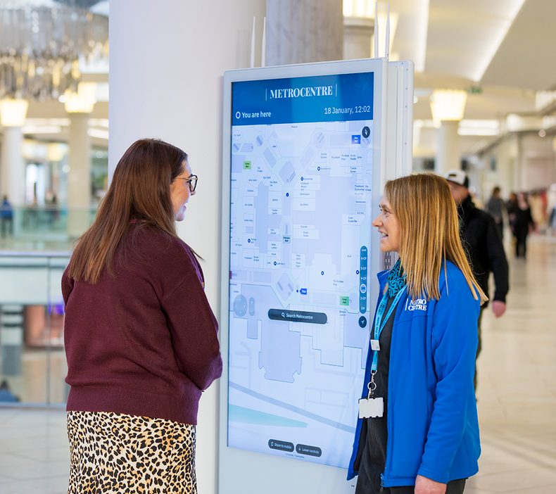
Metrocentre
Metrocentre, a 2,000,000 sq ft shopping and leisure destination with 3.3 miles of shop fronts, needed a better way to guide its visitors.
Routing & Wayfinding Map Manager System Analytics Dashboard
Read case study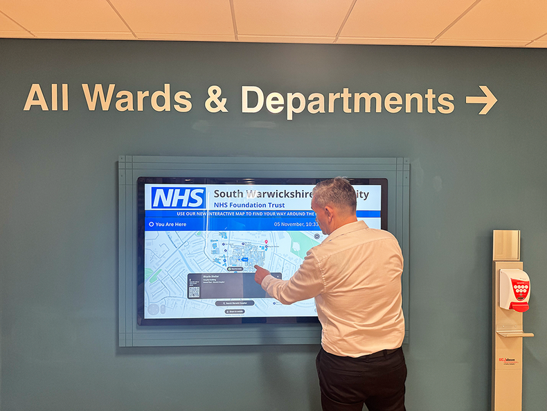
South Warwickshire NHS Trust
Limited parking and complex layouts at the South Warwickshire NHS Trust caused delays for visitors. The Trust began addressing this with a rollout at Warwick Hospital.
Routing & Wayfinding Map Manager System Analytics Dashboard
Read case study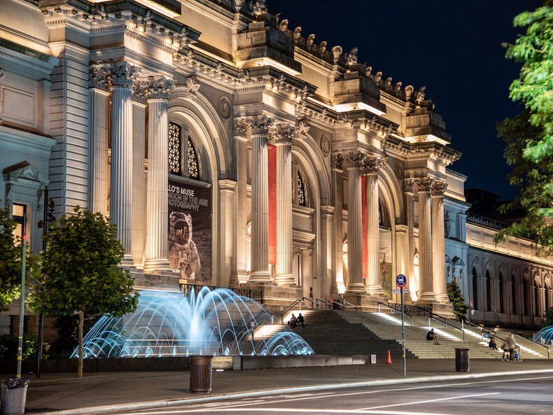
The Met
Living Map developed a dynamic, digital indoor mapping and wayfinding tool for one of the world’s largest and most iconic museums, New York’s Metropolitan Museum of Art (aka The Met).
Routing & Wayfinding Map Manager System Analytics Dashboard
Read case study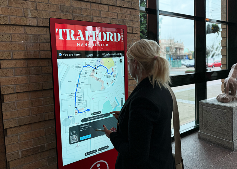
Trafford Centre
As a super-regional shopping and leisure destination, the Trafford Centre sought a digital mapping solution to enhance the experience for all its visitors.
Routing & Wayfinding Map Manager System Analytics Dashboard
Read case study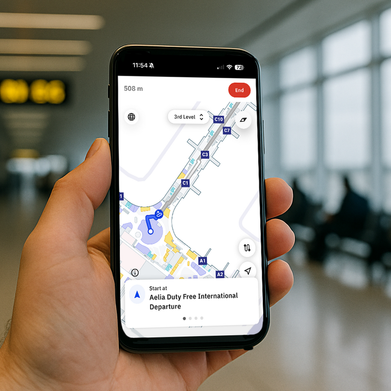
Lima Airport
With 24.5 million passengers in 2024 and even higher numbers expected in 2025, Lima Airport passengers needed a tool that helps them get around easily, reducing stress and anxiety as they navigate this busy space.
Routing & Wayfinding Map Manager System Analytics Dashboard
Read case study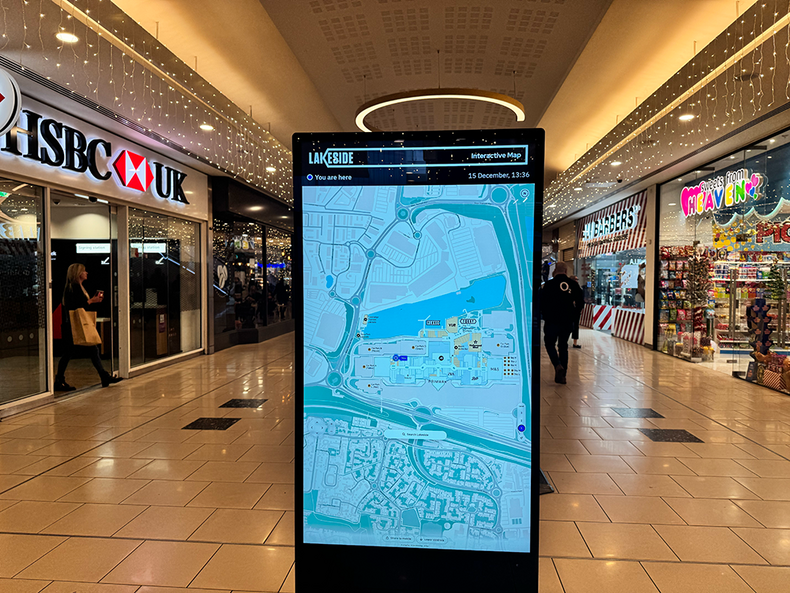
Lakeside
Living Map is now helping Lakeside improve internal operations and visitor experience with a digital wayfinding solution.
Routing & Wayfinding Map Manager System Analytics Dashboard
Read case study
Hilton Anatole
Living Map enhances Hilton Anatole events with real-time wayfinding, interactive maps, and accurate directions for smoother navigation and better guest experiences.
Routing & Wayfinding Map Manager System Analytics Dashboard
Read case study
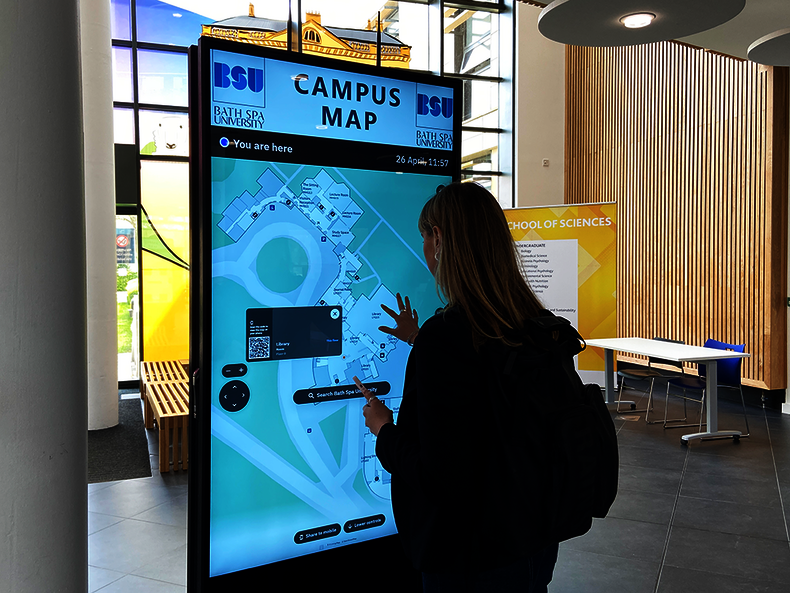
Bath Spa University
Living Map developed an accessible digital mapping and wayfinding tool for students, staff and visitors at Bath Spa university.
Routing & Wayfinding Map Manager System Analytics Dashboard
Read case study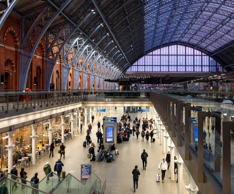
St. Pancras International Station
With millions travelling through the station each year, St. Pancras International required better promotion of its facilities, and a wayfinding solution to enhance the passenger experience, improving navigation to train platforms, shops, restaurants, and cafes.
Routing & Wayfinding Asset Locator Analytics Dashboard Map Manager System
Read case study
Canary Wharf
Canary Wharf embarked on a mission to enhance visitor experience through a digital wayfinding strategy.
Routing & Wayfinding Map Manager System Analytics Dashboard
Read case study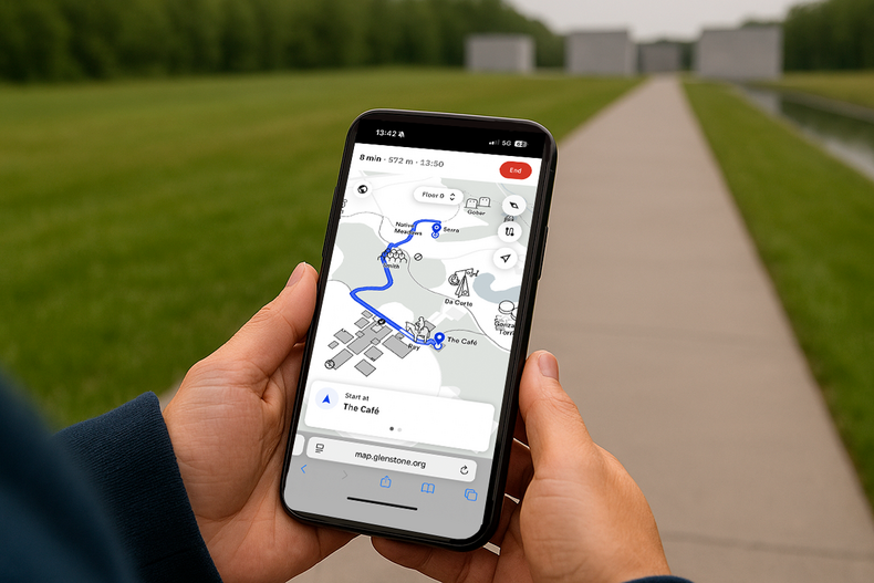
Glenstone Museum
Glenstone uses Living Map’s digital wayfinding to cut waste, support sustainability, and offer clear, accessible navigation in English and Spanish for all visitors.
Routing & Wayfinding Map Manager System Analytics Dashboard
Read case study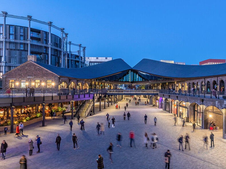
King's Cross
King’s Cross, renowned for its diverse mix of shops, cafes, bars and restaurants nestled within its cobbled streets and brick arches, aimed to optimise visitor exploration.
Routing & Wayfinding Map Manager System Analytics Dashboard
Read case study
City of Edmonton
City of Edmonton partnered with Living Map to create a dynamic digital map that reflects the city's distinct seasonal identity.
Routing & Wayfinding Map Manager System Analytics Dashboard
Read case study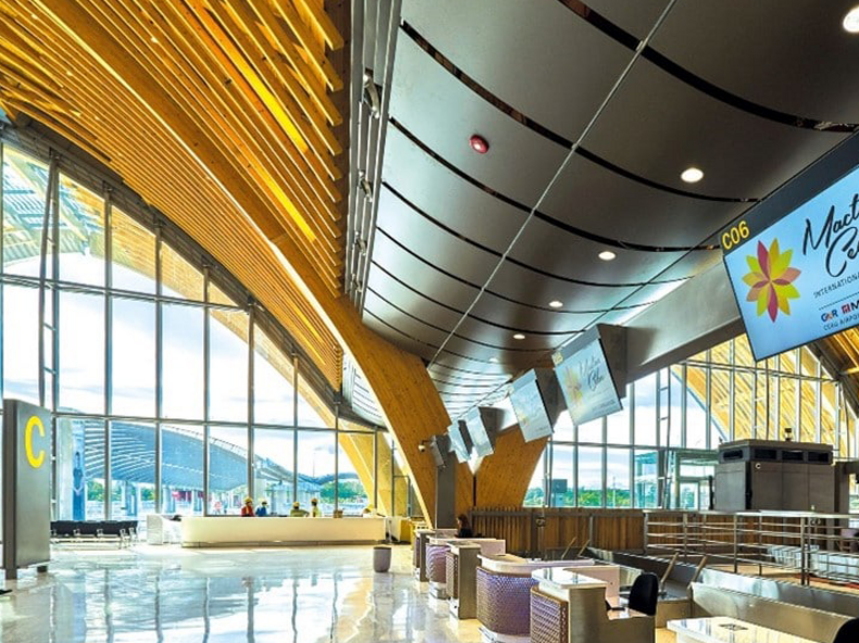
Mactan-Cebu Airport
As the second busiest airport in the Philippines, handling over 12 million passengers annually, Mactan-Cebu Airport needed a smarter way to streamline operations and deliver a high-quality passenger experience.
Routing & Wayfinding Map Manager System
Read case study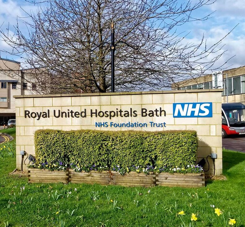
Royal United Hospital, Bath
During the Covid-19 response, healthcare professionals were deployed to unfamiliar cities across the UK. Hospitals needed a reliable way to guide staff to key locations, including the Royal United Hospital in Bath. Living Map delivered the solution.
Routing & Wayfinding Map Manager System
Read case study