How Living Map and Corbel are bringing indoor maps to life
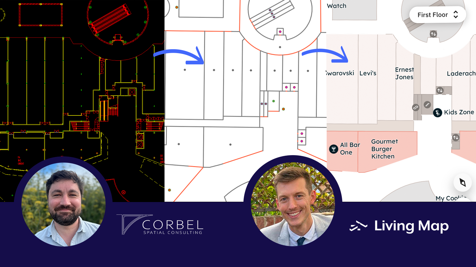
Living Map and Corbel work together to transform complex architectural drawings into fully interactive digital indoor maps. Corbel converts raw CAD/DWG files into standardised IMDF formats, which Living Map then enhances with routing and wayfinding, asset tracking, and branded visualisations. This collaboration makes large, complex spaces like hospitals, shopping centres, airports easy to navigate for visitors and staff.
Turning architectural drawings into digital maps
Corbel transforms all types of raw, messy, real-world architectural floorplans into clean, lightweight, accurate IMDF files that can be used within the Living Map ecosystem. Their work ensures that even the most detailed architectural drawings, often provided in PDF or DWG format, can be translated into IMDF, an open format ready for digital mapping of indoor spaces.
James, GIS Team Lead at Living Map, explains, “DWG drawings vary in vector quality from client to client, and rarely do they contain a ‘World File’ which would provide the georeferenced information. Corbel helps to reduce the complexities of working with DWG, which allows us to concentrate on producing the best maps possible for our clients.”
What are CAD / DWG files?
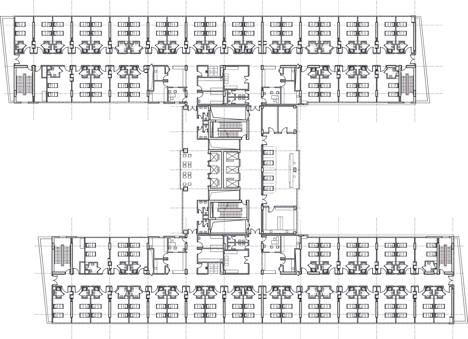
CAD stands for Computer-Aided Design. DWG files are used by architects and engineers to design and plan buildings and contain everything from walls and rooms to doors, staircases and utilities. While incredibly detailed, the layers are not structured in a way to produce geographically aware digital maps straightaway.
James notes “Although these architectural drawings provide the foundations for our maps, there is still a significant amount of work involved in preparing the data. In CAD, objects (lines, polylines, points) have no relationship to each other. To go from CAD to GIS, it requires topology with points, lines and polygons in a standardised data structure.”
What is IMDF?
IMDF, or Indoor Mapping Data Format, is an open standard used to describe indoor spaces in a consistent and structured way. It allows information about rooms, levels, and points of interest to be understood by mapping platforms and transformed into interactive digital experiences.
Working together: from DWG to digital wayfinding
Living Map and Corbel work together to turn CAD drawings into validated IMDF files. Corbel plays a central role in bridging the gap between architectural design and a fully interactive digital map. As James explains, Corbel georeferences and converts the DWG files so they align with the real world, whilst structuring them into an industry standard such as IMDF.
Corbel’s conversion process combines AI computer vision technology with human-in-the-loop review to achieve quick and efficient conversions without sacrificing the quality of the data product. Corbel’s deep expertise in mapping airports, railway stations, hospitals, offices, and shopping malls allows platforms like Living Map to deploy a map solution to any venue imaginable.
Once the IMDF package is received, the Living Map team transforms it further. James describes this final step: “After we receive the IMDF, we convert this into our own Living Map format, utilising the foundations of IMDF. We then go on to match it with the client’s brand and cartographic style, add additional attribution and features like Multi-Language and Routing to make the map a richer experience.”
The result is a fully interactive mapping environment that can guide visitors around a shopping centre, help staff and patients navigate a hospital or support teams in locating important on-site equipment.
What’s new in this space?
“Indoor mapping is a young, fast-growing industry perfectly positioned to take advantage of the innovations happening under the umbrellas of “smart cities”, “digital twins”, and “agentic AI”. Especially in face of the empty hype and misleading buzzword marketing that pervade the present moment, tried-and-true platforms like Living Map and data production partners like Corbel continue to deliver solutions that positively answer the basic questions that everyone looks for in a service: Does it work? Does it help? Is it good?” explains Peter Von der Porten, GIS Manager & Principal at Corbel.
Summary
Together, Living Map and Corbel streamline the journey from architectural drawings to fully interactive digital maps that provide essential services like routing, asset location and data analytics. By combining Corbel’s IMDFs with Living Map’s expertise in user-facing experiences and wayfinding design, complex indoor environments become intuitive and navigable spaces.
Interested to learn more? Chat to our team of experts.
Insights shared by James Bible, GIS Team Lead at Living Map & Peter Von der Porten, GIS Manager & Principal at Corbel Spatial.
FAQs
What is digital wayfinding?
Digital wayfinding is the use of interactive indoor maps and navigation tools to help people find their way around complex spaces. Living Map provides both the maps and user-friendly routing to improve visitor and staff experiences in hospitals, shopping centres, airports, museums, universities, and other smart spaces.
What is IMDF?
IMDF, or Indoor Mapping Data Format, is an open standard that describes indoor spaces in a consistent way. It allows mapping platforms like Living Map to interpret rooms, levels, and points of interest accurately for interactive digital maps.
Request a demo
Experience the power of our mapping, wayfinding, and asset tracking technology for yourself. See how our software can enhance your facility.