Is digital wayfinding worth it for a smaller or community shopping centre?
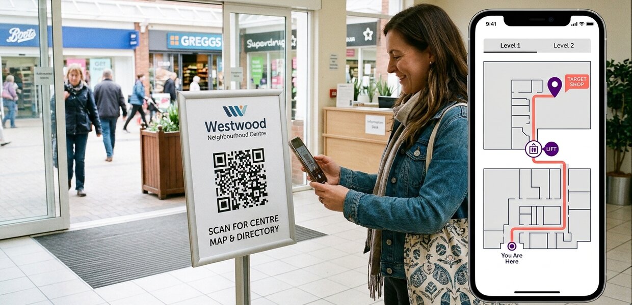

Yes, if it's scoped to the size of the centre. For a smaller or community centre, that usually means a web map visitors open on their own phones, few screens or none, and a map your own team can keep right.
Digital wayfinding is often talked about as something for the big malls, with screens on every concourse. A smaller centre doesn't need that to get the main benefit: visitors who can find the shop, the toilets or the way back to the car park without having to ask.
What does a smaller centre actually need?
Most of the problems are the same as in a big centre, with fewer people to deal with them. Units change hands. The printed directory falls behind. Whoever is on the desk spends part of the day giving directions. Even smaller shopping centres can be a challenge to navigate around.
As well as the size of the space, the difference is the budget and the size of the team that manages the centre. So start with what visitors already carry. A web map opens in the phone's browser with nothing to download. And because everything about a view of the map lives in its web address, a QR code at an entrance can open the map right where the visitor is standing.
What does a typical smaller project look like?
A two-level community centre might start with:
- a web map, linked from the centre's website
- QR codes on signage at the main entrances and in the car park that open the map
- step-free routes between the two floors, including the lift (elevator)
- unit changes made by the centre's own team through the Map Management System (MMS), or by the Living Map team if that suits the centre better
This is an illustration of how a smaller project can be scoped, not a description of a particular centre. Screens can come later, or not at all, depending on budget and need. Some screens run ads above the maps - this may affect rates due on the shopping centre depending on local laws, so owners and operators of shopping centres should take this into account when planning and budgeting for projects.
Who keeps the map up to date?
In a smaller centre, the person who updates the map is often also running marketing, looking after tenants and covering the desk. So the way updates happen has to fit the team.
Clients can update their own map through the MMS, and the Living Map team can take on some or all of the updates. How the work is shared depends on the centre's own resources and how often the map needs to change. As Nick Jeffery, who heads up Operations at Living Map, said in a recent interview: “The aim is for clients to feel entirely confident in making changes themselves, freeing them from reliance on us for routine updates.”
What drives the cost?
There's no single price. Cost depends on how sophisticated the project is, not just square footage: how many floors, how many buildings, how complex the site is, and what technical information you already have, such as whether CAD drawings exist, what quality they are in, and whether they are kept up to date. As a ballpark, projects range from a few thousand pounds up to around £250,000, depending on complexity. The costs usually come in a blend of capex spend up front and monthly/quarterly opex spend - some suppliers may offer flexible solutions on this, depending on contract length etc.
So the useful first step is to look at your own centre through those questions, rather than at what a much larger centre might have spent.
Can we start small and add more later?
Yes, absolutely. This is actually very typical - a wayfinding project will evolve over time, just like the space itself. What we tend to see is that a standard wayfinding map evolves as the relationship, the space and the technology evolve. Layers of other services and nearby locations are added, and as other people in the organisation see the benefit, they use the same map for other jobs, such as knowing where the signs and lifts are.
For a smaller centre, that means the first version doesn't have to do everything. It has to be right, and easy to maintain.
You can see how a busy centre uses Living Map in the Metrocentre case study, or read our digital wayfinding FAQ for shorter answers to common questions. If you run a smaller centre and wonder whether this fits, happy to talk it through.
Request a demo
Experience the power of our mapping, wayfinding, and asset tracking technology for yourself. See how our software can enhance your facility.